The every-street game for runners + cyclists
Turn every run and ride into a street-by-street quest.
Connect Strava and StreetFerret maps your activities onto streets and cities — so you can see what you’ve covered, what you missed, and what to chase next.
No ads. Never sold. Built by endurance nerds with a map problem.
0
0
0
Why StreetFerret
Strava records effort. StreetFerret reveals territory.
Know exactly what streets you have covered, what is still open, and what route makes progress today. Built for runners and cyclists who want clear goals every time they head out.
How it works
- Connect Strava onceActivities sync automatically so your map keeps updating.
- Get city progress mapsStreet coverage is calculated across your Strava history, city by city.
- Plan the next gapUse map gaps, live tracking, and leaderboards to keep momentum.
Map Lab
See what StreetFerret actually does with your miles.
Pick a feature, watch it in action, and see how StreetFerret turns raw Strava activities into street-by-street progress you can chase.
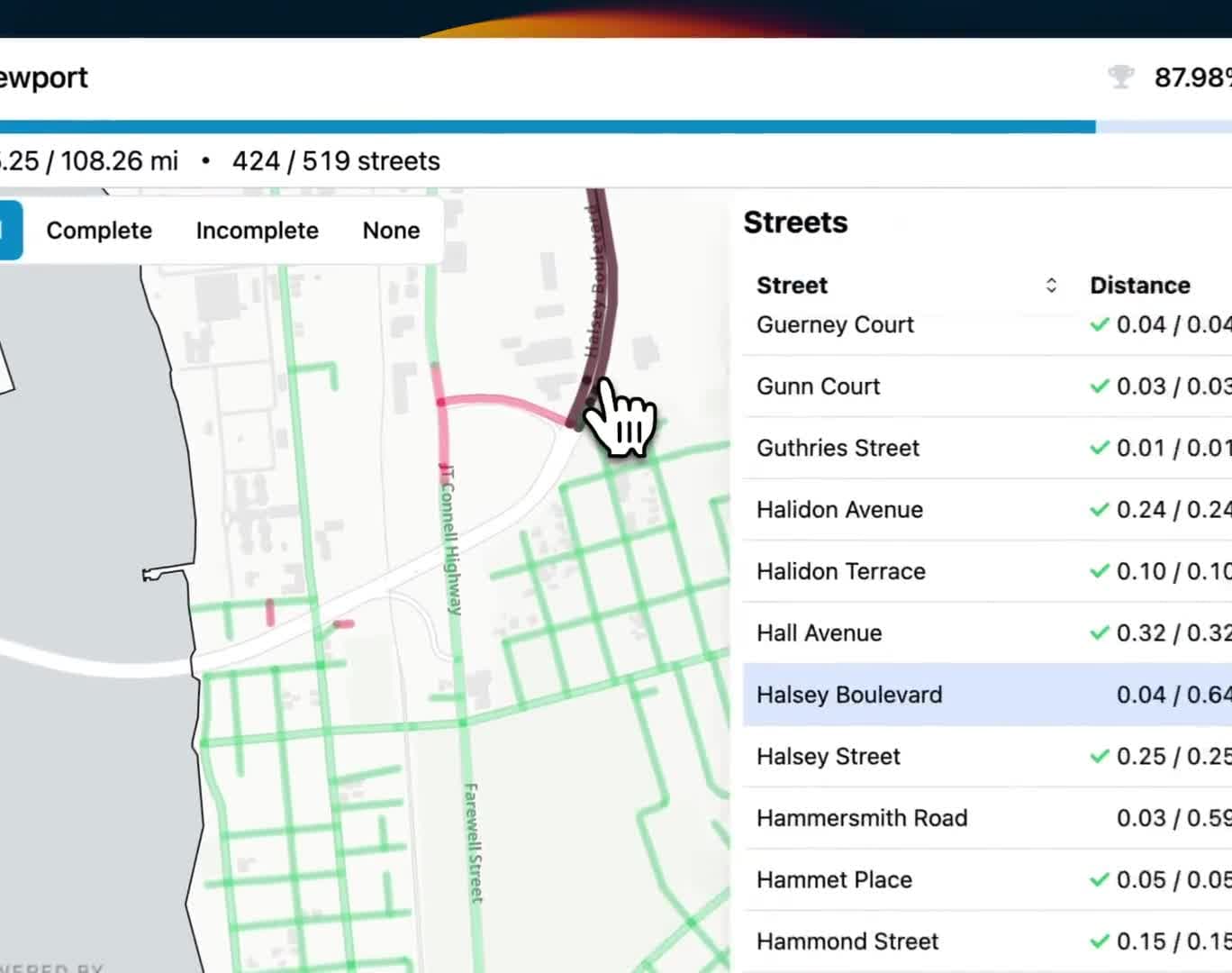
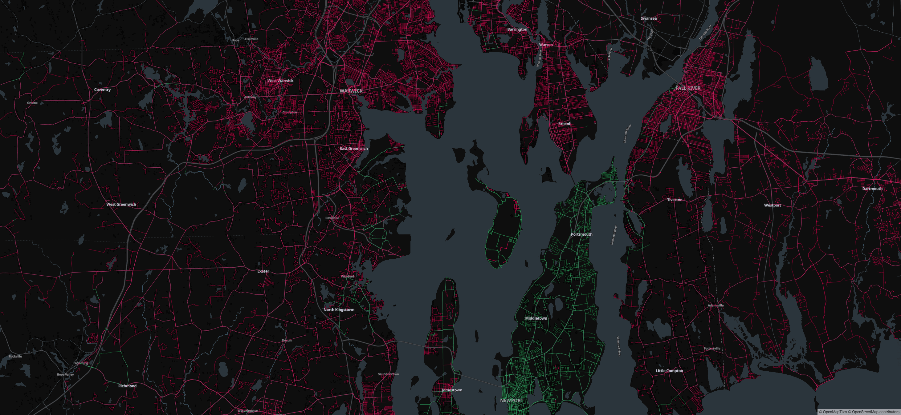
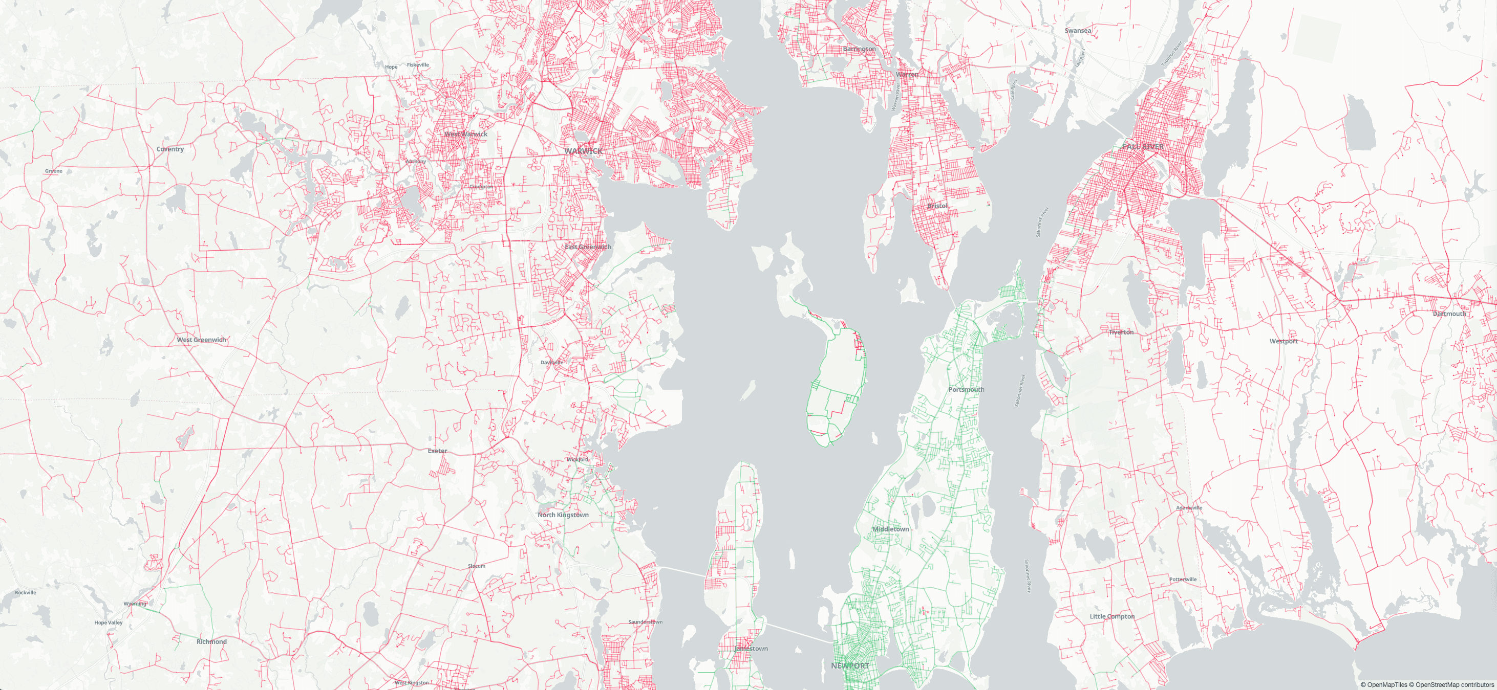
Completion Map
Turn every run or ride into visible progress so you always know what streets are left.
Street-by-street coverage updates from your synced Strava activities.
Connect Strava to build your map, find your next streets, and keep momentum high.
Real usage, worldwide
A global map of daily decisions.
Spin the globe to see where StreetFerret users are recording streets. Every marker is a run, ride, or one-more-block choice.
Start your map
Connect Strava. See your streets.
No ads and no data selling. Just a cleaner way to explore and a clearer reason to get out the door again.
By connecting, you agree to our Terms and Privacy Policy.